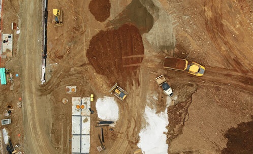
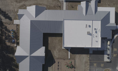
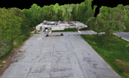
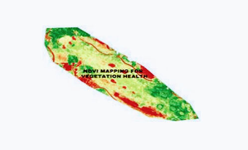
Aerial Mapping

Increase efficiency by using the latest technology to get the edge in managing your data. Get feedback in real time about the progress of your project with instant maps, measurements, and analysis. From the bid process, pre-construction site planning, to progress tracking, drones will play a vital role in enhancing your project.


 Global Air Media Is An FAA Certified Drone Company, specializing In Aerial Mapping Which Acquires Actionable Data (Actdat) Using The Latest Technology And Software.

 
line.png

Why Global Air Media

Our FAA certified and Insured Team brings over 20 years of experience in Drone Piloting, and Project Management. Through our technical proficiency and dedication to perfection, we guarantee your satisfaction with our quality of work.

Whether it is contour mapping for architects planning their next project, or 3 dimensional maps for historical records, global air media approaches the project with a professional, well thought out plan of action to acquire and submit data to clients.

sep.png
 

 Fast & Accurate Surveys and Amazing Photography


Aerial_Mapping.jpg

Mapping

Use real time topographic & contour maps to expand your planning capabilities. Import your data into programs such as AUTOCAD. Whether your project is in construction or land management, drones are guaranteed to save you time and money.

Thermal_inspection_drone.jpg

Thermal Inspection

Use Drones to perform infrared thermographic (IRT) inspections to check for radiation and heat loss. IRT inspections can save Superintendents and Project Managers money and time.

Mapping_ Drone.jpg

Stockpile Measurements

Use drones to measure valuable assets at your site or on your project. Our measurements are accurate, fast and a fraction of the cost of traditional methods.

Construction_drones.jpg

Aerial Surveys

Get accurate land measurements with the use of drones and Ground Control Points (GCPs) to get the level of accuracy you need for your project

Drone_Construction_Pricing.png

CONSTRUCTION PRICING


VALUE PACKAGE

4K Photography

(30) Drone/Aerial Photos

~1 Min Unedited Video

$350

VIDEO PACKAGE

Promotional Video (~90sec)

Drone Photography + Video

Interior Virtual Tour

Photos

$950

MAPPING PACKAGE

DATA Analysis Report

Topographic Map

Stockpile Measurements

3D Site Rendering

$1,095 (< 5 Acres)


‘ACE' PACKAGE

Promotional Video

4K Photography

Topographic Map

DATA Analysis Report

$1,495


3D ARCHITECTURAL RENDERING

See your building FINISHED on site with a 3D rendering on video! Call for more details!

Starting at

$2,950


Use real time topographic & contour maps to expand your planning capabilities. Import your data into programs such as AUTOCAD. Whether your project is in construction or land management, drones are guaranteed to save you time and money. Mapping outputs include 3D maps, Topographic, and Normalized Difference Vegetation Index

line.png
 

Did you know that in addition to using drones to market their club, Golf Course Superintendents, use drones to inspect their courses using hi-tech NDVI maps to check the health of vegetation. Check out this video we did for the famous Caves Valley Golf Club.


Get a Quote

To get a quote, learn more about us, or schedule your first flight, please tell us a bit about yourself. A member of our team will get back to you with more info and pricing soon.